Bozeman, Montana! June 2019

Well some of us had a few things going on the last several months and our blog posts kind of took a back seat! But we’re getting caught up now and we have a lot to show you! Bozeman is truly a location of its own in Montana. It reminds us of a more open and spread out Boulder, CO with a lot more to offer. The downtown area is excellent with some great shops and restaurants. The housing market is booming and there’s so much to do within an hour or two on a daily basis that you can’t possibly even attempt to do it all in 8 days. While we attempted to do a lot, more than anything we just wanted to spend time with our friends we hadn’t seen in a while. Below are some highlights.

Eating

We loved eating at Sidewinders. The food and drinks were excellent, and there is even a play area for kids with video games. We also loved having Gelato at Mavens in downtown Bozeman, which we enjoyed on more than one occasion in our time there. If you love Breweries like we do you also have to check out MAP. The food and beer are fantastic.

Favorite Things

We spent a quick minute in Big Sky and took the Tram to the top for a quick sight seeing view. The rest of the area was mostly shut down in between seasons so we didn’t get to see a whole lot. However, we were able to do a quick, easy, but pretty hike to Ousel Falls.

Some other area favorites:

Yellowstone….goes without saying, but be forewarned, you will be battling tons of people like Disney World.

The Bridgers, some of the best trails are in the Bridger Mountains and there are very few people around. We hiked up to Fairy Lake which was truly breathtaking!

STAY AWAY from South Cottonwood Trail. It’s basically an open Dog Park trail which smells terribly of dog poop with much of it on the trail as owners don’t clean up after their pets.

More than anything we enjoyed spending time with our friends, riding bikes, enjoying the weather, and exploring the city of Bozeman.

Baughn Adventures Summer 2019

family picture at Orlando International Airport
Super rushed photo before running to TSA Precheck. We almost missed our flight due to Cows getting loose on 528!

Intro

When both parents work and kids are in school as well as participating in extracurricular activities, time tends to fly by between family trips. Last year we opted not to take a family summer or winter trip due to just buying our new house and needing to fix it up a bit. So this summer we decided to Go Big! Our trip this summer is encompassing 28 days. I am fortunate to work for undoubtedly one of the best bosses in the world, enabling me to take all this time off from work. Laura works remotely now and is able to do a little work every night before bed.

Flights, Utah, and Idaho

One of these years I will learn my lesson and spend the extra money to travel a month later in the summer out west. However, we could not have asked for a better travel day thanks to Southwest and TSA. We had 0 delays, 0 lost bags, 0 crazy people, and 2 kids who behaved themselves unbelievably well for flying a total of 9 hours in a day, renting a car, driving 30 more minutes to a hotel for the night and finally getting to sleep around 2am eastern time.

We didn’t spend much time in Utah, but we drove through the Northern portion on the way to Idaho and it really is a beautiful area. It was off and on rainy the whole drive, but we were fortunate there was enough sun to enjoy the best parts of this quick jaunt.

For Idaho, we came back to an area we fell in love with on our trip out here 3 summers ago; the Teton Valley, specifically Driggs and Victor, Idaho. These two towns are separated by about 10 miles, but are closer than you’d imagine. We stayed in a great AirBnB this trip in Victor, Idaho. The place is a converted barn, but is really a great place, the owners live on the property and they are very friendly. We were sure hoping for some of the sunsets they usually get from this place, but unfortunately all we saw was rain and snow….on June 8th. However, that didn’t stop us from exploring.

We began our hiking adventure by hiking the Darby Canyon Wind Cave trail (clicking on the link takes you to my review and a few photos and details of our hike). In all it was close to a 7 mile hike with an almost 2,000 foot elevation climb. Both of our kids, Evan (8) and Olivia (5) did the entire hike like champs. The temps were in the low 50s, it was cloudy, and rainy and the entire last half mile or so of the trail was entirely covered in snow! If I ever plan better, my kids will be absolutely champs on trails with no mud or snow at all. Shots of some pics are below, but they don’t nearly do the views any justice, click each one to enlarge. We were constantly surrounded by clouds so getting glimpses of the rest of the Tetons as the trail usually promises were not very successful. However, we did manage to have fun and enjoy our time as well.

Today we spent a lot of time in the car as it snowed just about the entire day and we were all pretty wore out still from our hike. We started off with breakfast at Big Hole Bagels in Driggs. The food was fantastic and the prices were great. We definitely over ordered having no clue how big everything would be. The pancake was bigger than my daughters head…she also ordered eggs and bacon and actually finished that, but the pancake is a different story. Fantastic service and great food, we highly recommend this place.

Our second stop today was in Rexburg at the Yellowstone Bear World. It was far less than I expected. We saw a lot of bears which was neat having never seen any on any of our hikes…Thank God. However, you drive through the park, which takes probably 10 minutes tops to look at a few deer, bison, and a lot of bears, but you pay per person to drive your own car. Adults cost $17 and kids are $10. That does give you access to their walk through petting area with chickens, deer, pigs, and ducks as well as the small amusement type rides. However, I think we were there maybe an hour at the most. If I had to look back on it I probably would not do it again, even though both kids enjoyed seeing the bear cubs.

We did another very short hike to Upper Mesa Falls. If you can, try and go when it is going to be sunny. The falls are truly amazing regardless, but in the sun you can catch a rainbow in the mist floating up to the sky from the bottom of the falls. There’s a forest service building at the entrance to the trail full of information, stamps, gift shop, and you can get your National Park Pass stamped which is a plus for us!

Grand Tetons from a distance. Click to see full view.

Lastly we made our way back into town and FINALLY got view of the Tetons for the first time this trip. They had previously been blocked by clouds and we truly enjoyed being able to see them for all their splendor. If you’ve never seen them before they truly are beautiful, especially when covered with snow. We stopped and ate dinner at TJ’s Grill & Pizzeria in Driggs. What a great little place. The pizza was delicious, our server Jake was truly excellent, they are small, but quick and excellent service with great food.

That’s it for our first 4 days of our trip….onward to Bozeman, Montana to spend some time with our friends the Passmore’s! The kids have not stopped talking about seeing their friends again and time always go by so long before we realize we haven’t seen each other!

North Carolina “High Country” – Week 2

Our last week in the High Country of North Carolina began with a relatively easy drive from the Burnsville area up to Blowing Rock.  A drive to Blowing Rock though is not complete without a few pit stops first.  We weren’t really sure what to expect with the weather this week so we wanted to get some of our favorites out of the way first!

Beef Jerky OutpostValle Crucis, NC

This place has become a must stop for us on our trips up here.  First, Beef Jerky is great food to bring along when your hiking….until you run into a bear.  However, we’ve never seen a bear (knocks on wood).  It’s great protein, seals well in the package, and oddly both our kids love it!  There is an endless supply of all different types of jerky here.  From your normal every day orange teriyaki to deer, gator, snake, and camel.  They always have three types of samples for you as well!  The link to their Facebook page is in the header and click on the city of Valle Crucis in the paragraph header to go to the Google Map location as well.  You won’t regret it!

Over Yonder Restaurant – Valle Crucis, NC

Just a couple minutes down from the Jerky Outpost is the Over Yonder 
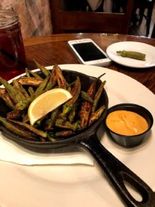
Restaurant.  It’s right across the street from the Original Mast General Store .  More on that in a minute.  Instead, let’s get to how good this okra was!  This wasn’t Cracker Barrel okra that’s for sure.  You could tell this was real and fresh!  Just take a look at this picture.  Considering this was a typical tourist time for them they were jam packed, but they fit us in right away, and food came out quick as well.  This was our first visit here and we loved it.  The cheese grilled cheese with the BLT salad was a perfect mixture!

As for the Mast General Store, if you’ve never been you should go, if only to say that you’ve been. The place is huge, and on the register of historic places.  Their prices are pretty descent for some of their gear and they always have a sale going on.  If you can’t find it here they have a surplus store down the road just a bit as well.  It really is a neat place, but be forewarned it will be crowded!

Appalachia Cookie Company – Boone, NC

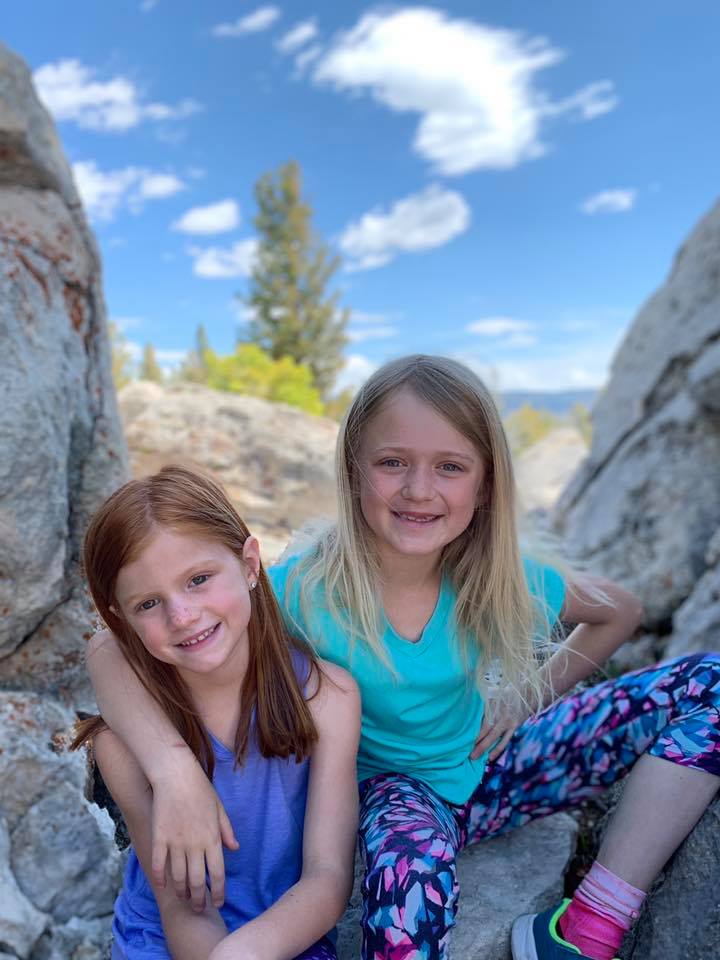
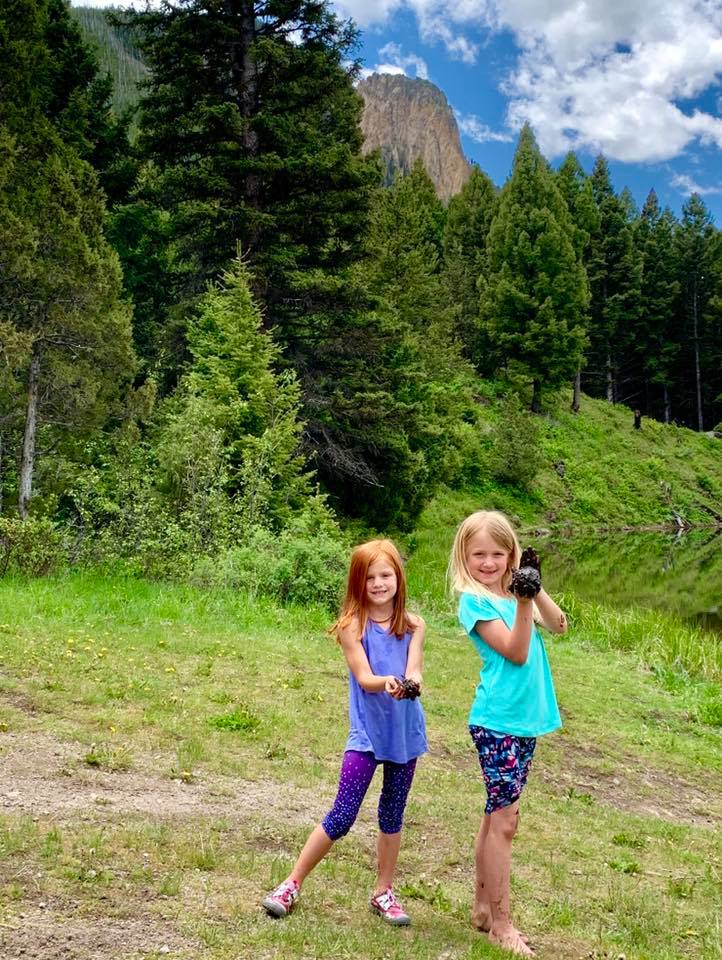
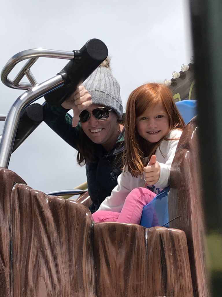
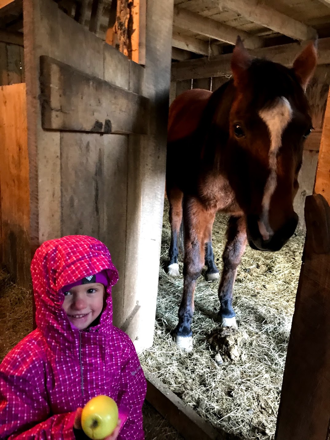
Last on our list for the drive up was this amazing place!  If you’ve never been here, you must stop in and order fresh cookies.  
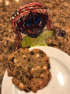
They are so good and they’ve even won an award or two.  We’ve tried every single on on the list and have had them shipped to friends as well.  Our favorite go to is the Blueberry White Chocolate Oatmeal….you won’t regret it.  By the way the picture to the right is Flat Stella, she went everywhere with us on this trip.  Flat Stella was a school project for our daughter.  Stella had to go places with us and do things with us, and then my daughter had to draw the corresponding pictures.  Funny thing though, this picture is real, but many of the Flat Stella pictures we took I had to photoshop Stella in because we forgot to take pictures with her!

Chetola Resort – Blowing Rock, NC

The place we called home for our second week was the Chetola Resort.  The entire size of the facility was very big.  We had a two bedroom condo unit and while the pictures on their website didn’t reflect the unit we stayed in, it wasn’t 
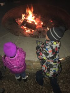
too bad.  The master bathroom shower had issues all week with the faucet and the hot water and the heating in the unit itself struggled to keep up with temperatures in the single digits. They had a fire pit where they held a “bonfire” as they called it.  It was more like 4 or 5 logs and they sold hot chocolate for $3 and a paper bag to make 3 smores for $5.  That was kind of a downer for me.  All in all it was quiet, we slept well, and it was a nice location as we love the downtown Blowing Rock area.

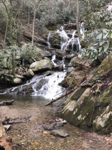
Hikes – Linville Falls-Plunge Basin

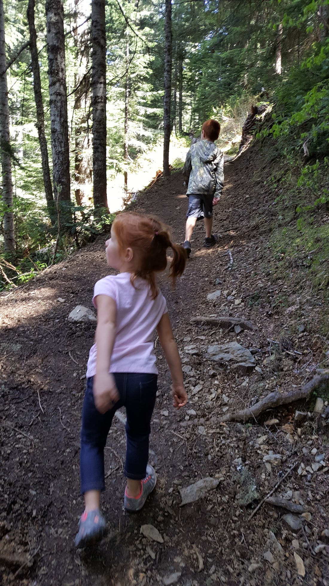
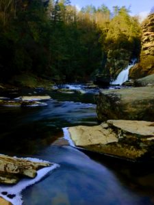
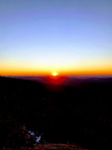
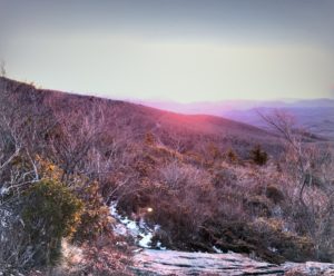
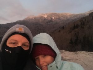
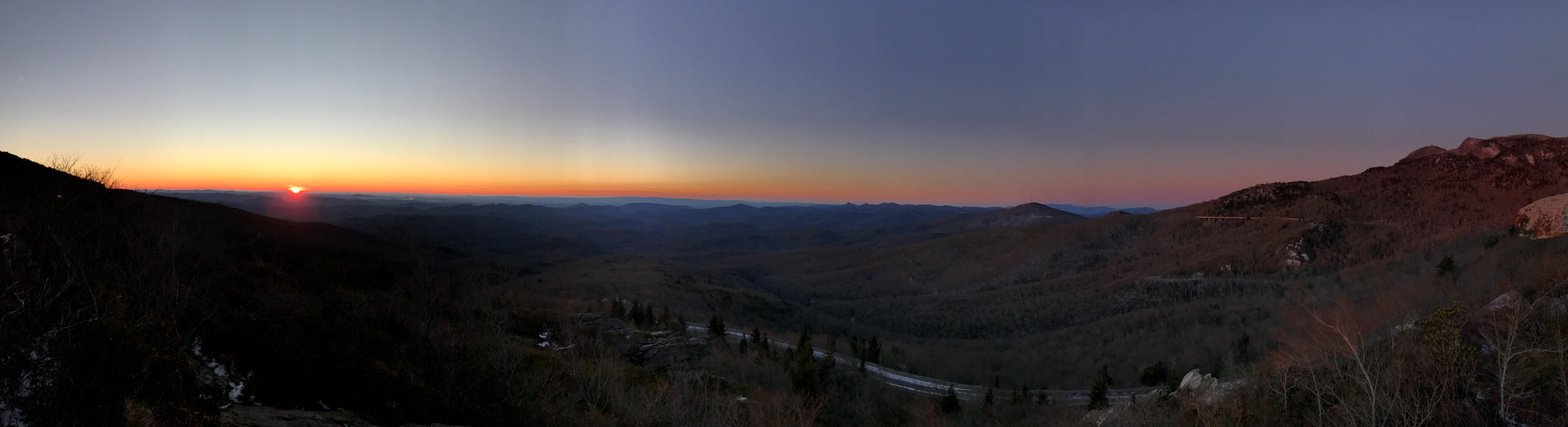
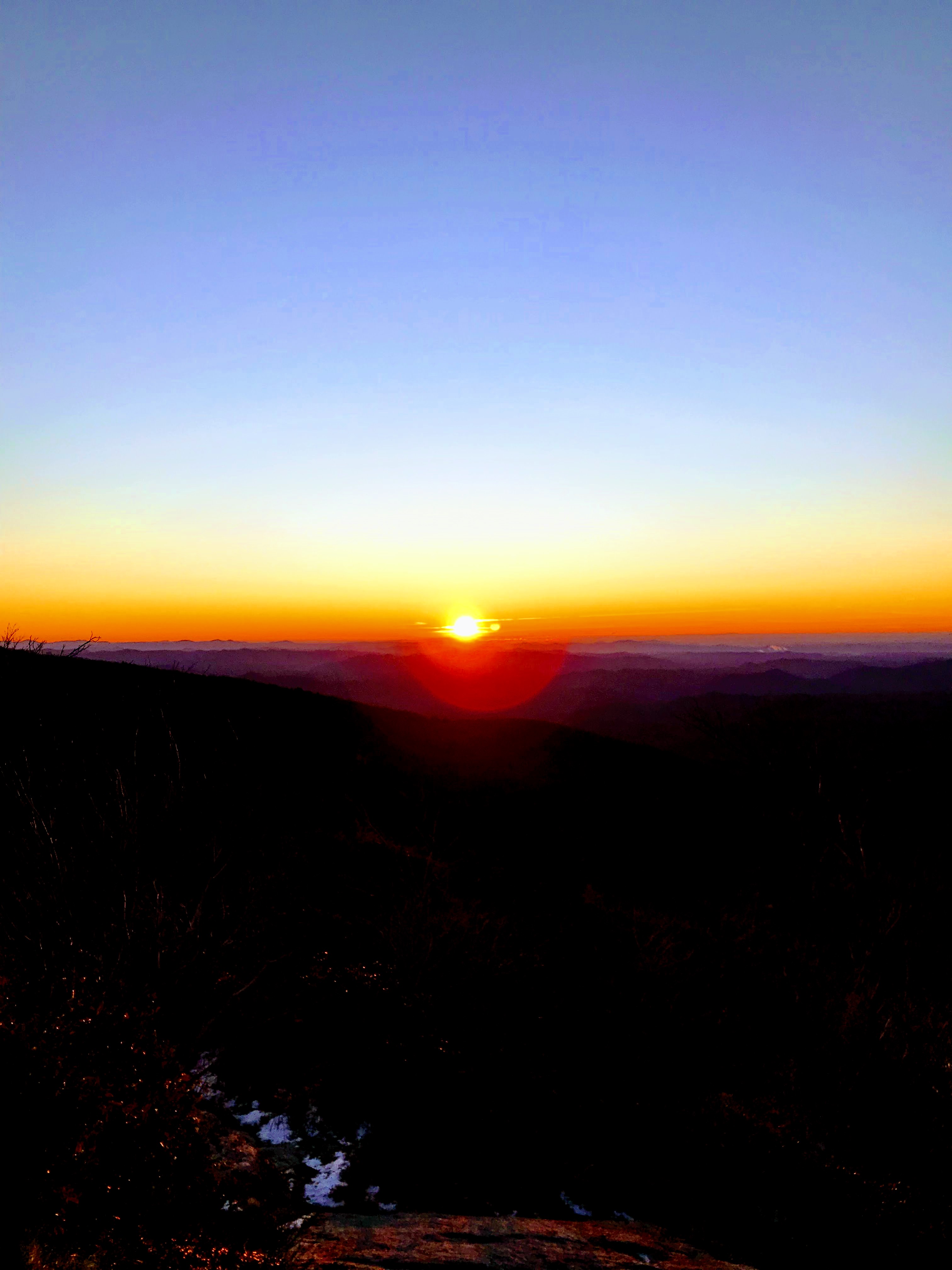
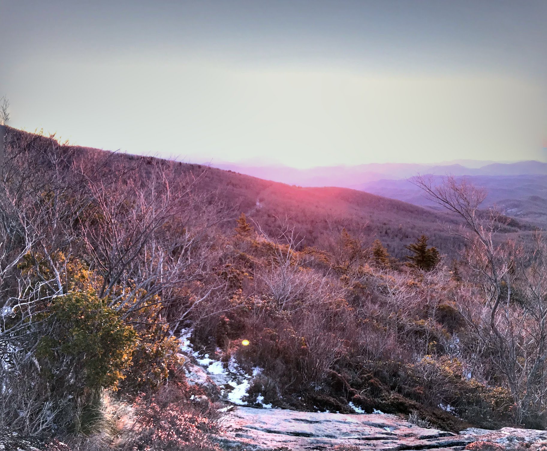
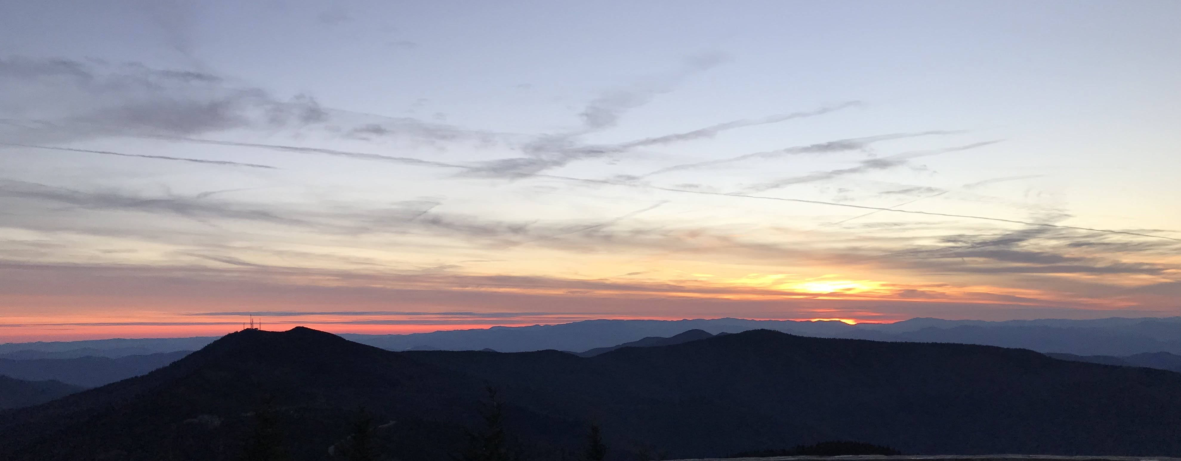
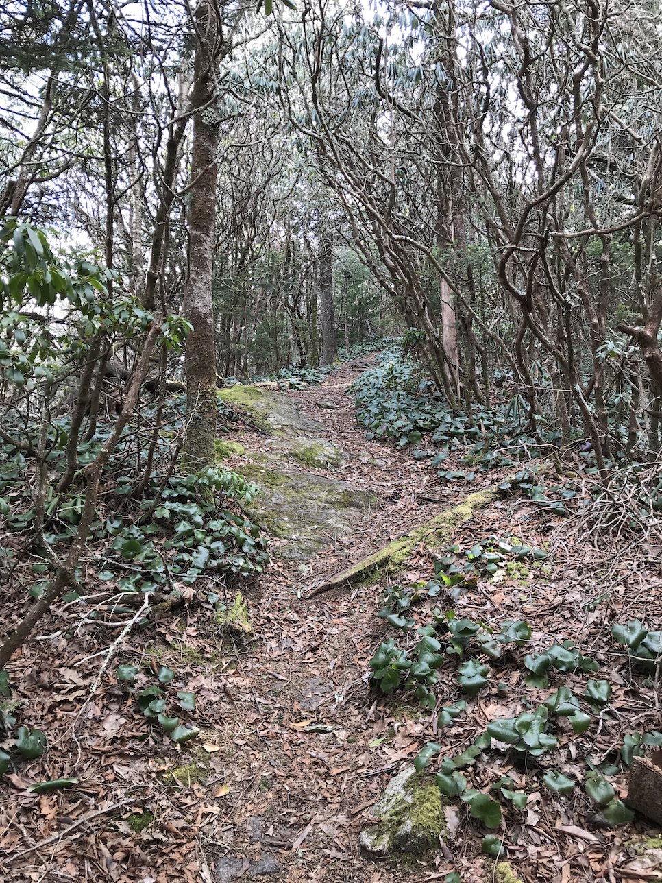
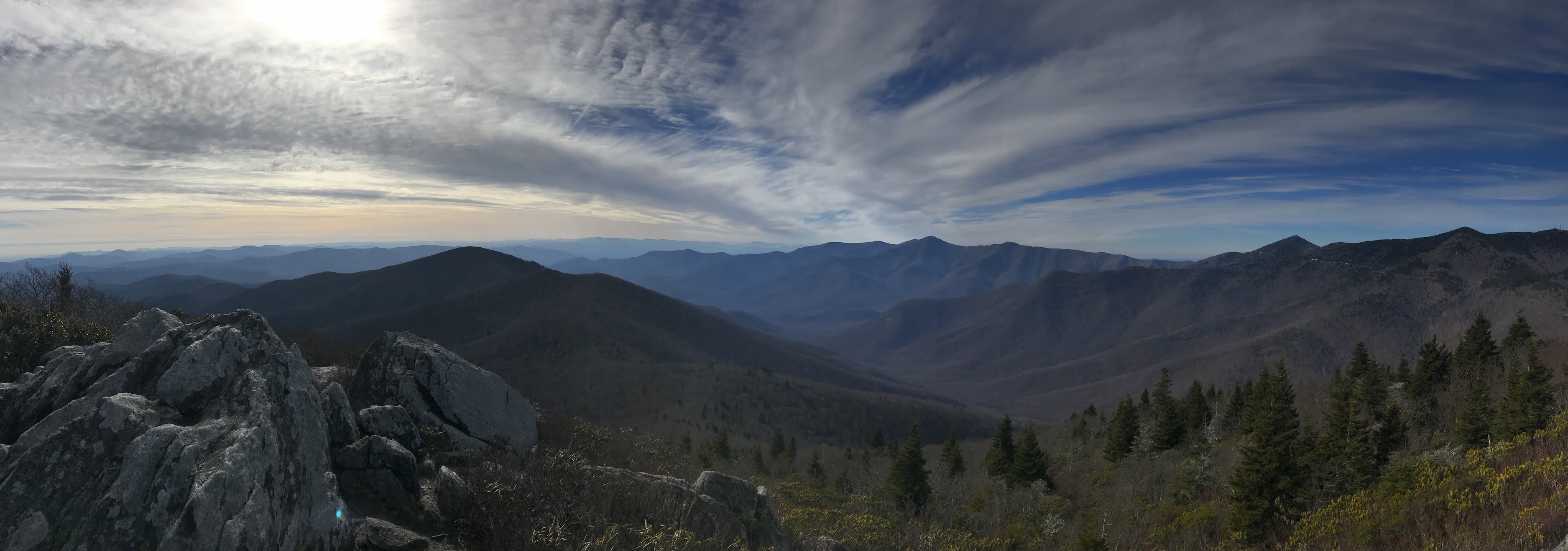
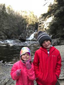
It was so brutally cold that we were only able to complete 3 hikes all week.  If you include the two times my wife and I woke up to watch the sunset from a rock on the Rough Ridge trail, well then that’s 5 hikes.  As a family though we completed 3.  The first hike was Linville Falls-Plunge Basin , and this was a great hike.  When I mentioned before that our daughter does not do well with easy hikes, we meant it.  This trail was slippery with ice, huge boulders, quite a bit of mud, and a drastic elevation change and she loved and hiked 
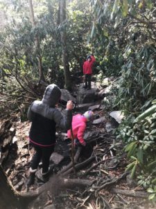
every step of the 2 mile hike.  This was one of the more fun hikes, and one I’d love to come back and do in the summer when it’s hot and you can jump in the water.  Being that it was a little more than 20 degrees, we hid from the wind at the basin floor and ate lunch before beginning our climb back.

Beacon Heights Trail to Grandfather View

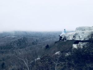
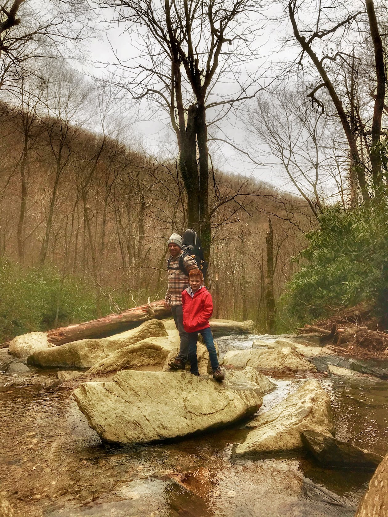
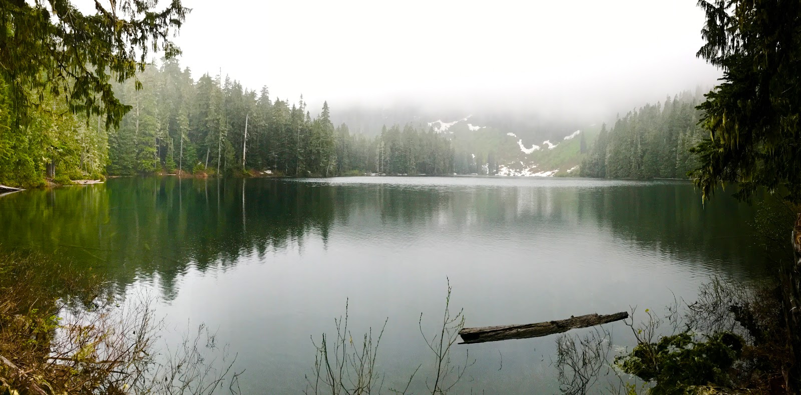
This hike was a random decision to stop and hike.  We wanted to spend more time outside today as we knew that the cold front was coming in.  This hike was brutally cold because of the wind.  It was quite unreal how much the wind was howling and how the clouds were flowing over the mountain peaks.  The views were pretty.  It was a very short trail, our daughter actually fell asleep in the Deuter carrier she was so worn out from the previous hike we had just completed.  It was a short hike, 30 minutes total, but we got some good pictures to share in short time.

Crabtree Falls

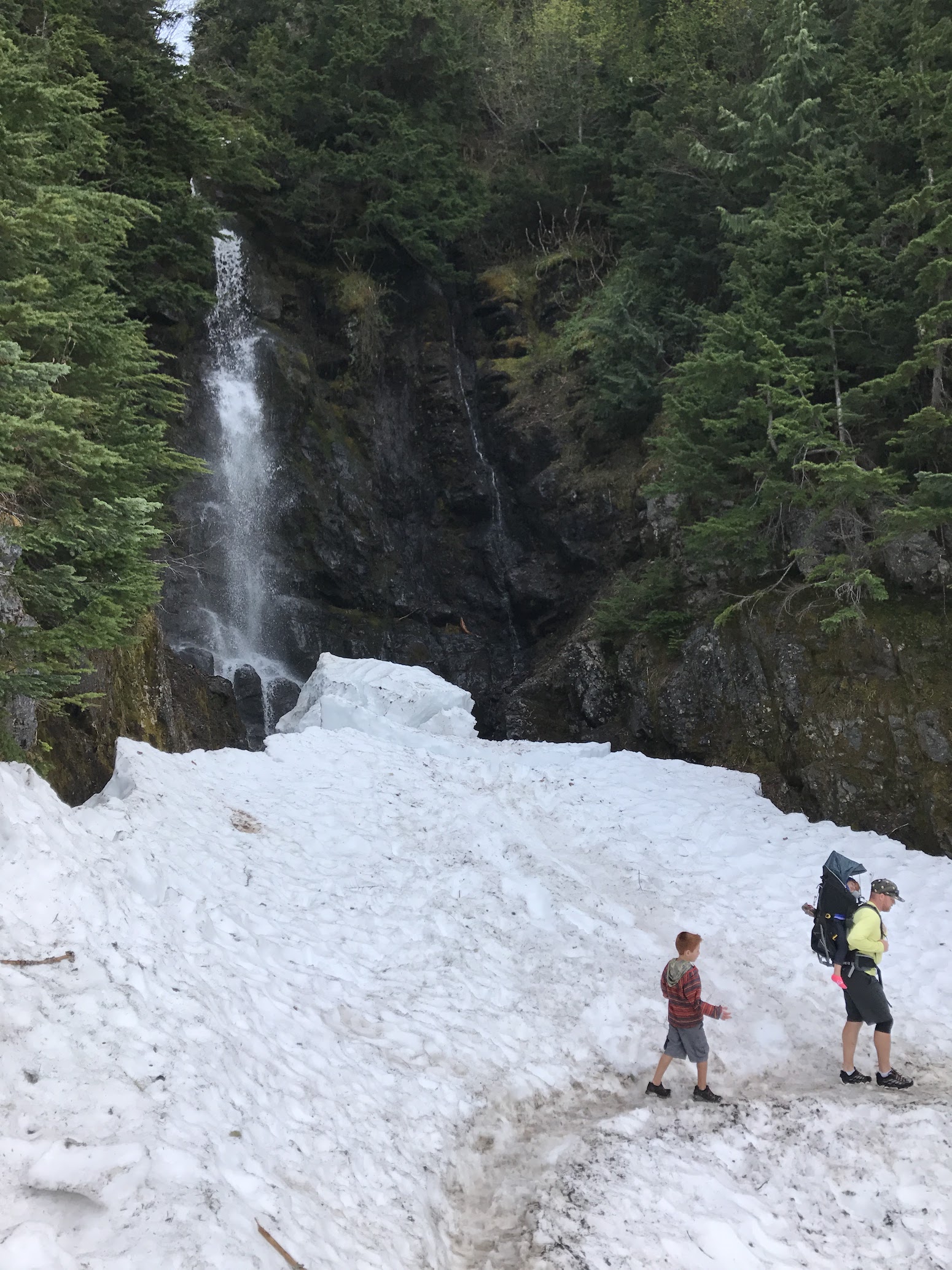
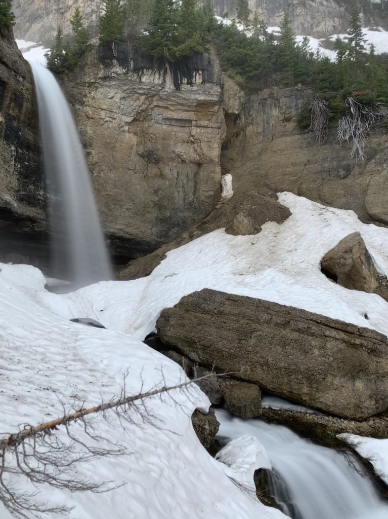
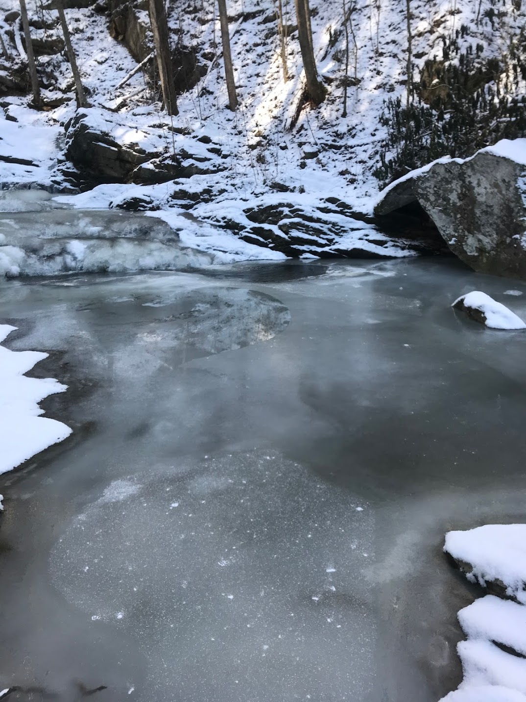
Let me begin this description with the fact that there was no expectation for snow the entire week we were supposed to be there.  What does it do?  It snows a half inch the first day and about 3 inches the 3rd day we were there.  We didn’t mind though as it afforded us the opportunity to do a hike mid-morning to Crabtree Falls.  It had just snowed 3 inches, and we were the ONLY people at the trail head.  I came to appreciate this more than most things this week.  It was so quiet and peaceful…except for the 
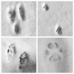
occasional snowball the kids were throwing.  What was great was the animal prints we could see in the snow.  The kids loved trying to figure out what each print was, where it went, what it was doing, and were they looking at us as we were hiking.  As we made it to the falls, the temperature was about 15, but the sun was out and there was hardly any wind.  The falls were mostly frozen over and covered with snow.  It was very peaceful and beautiful at the same time.  This trail took us about an hour total and was a good warm up for the rest of the day.
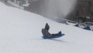
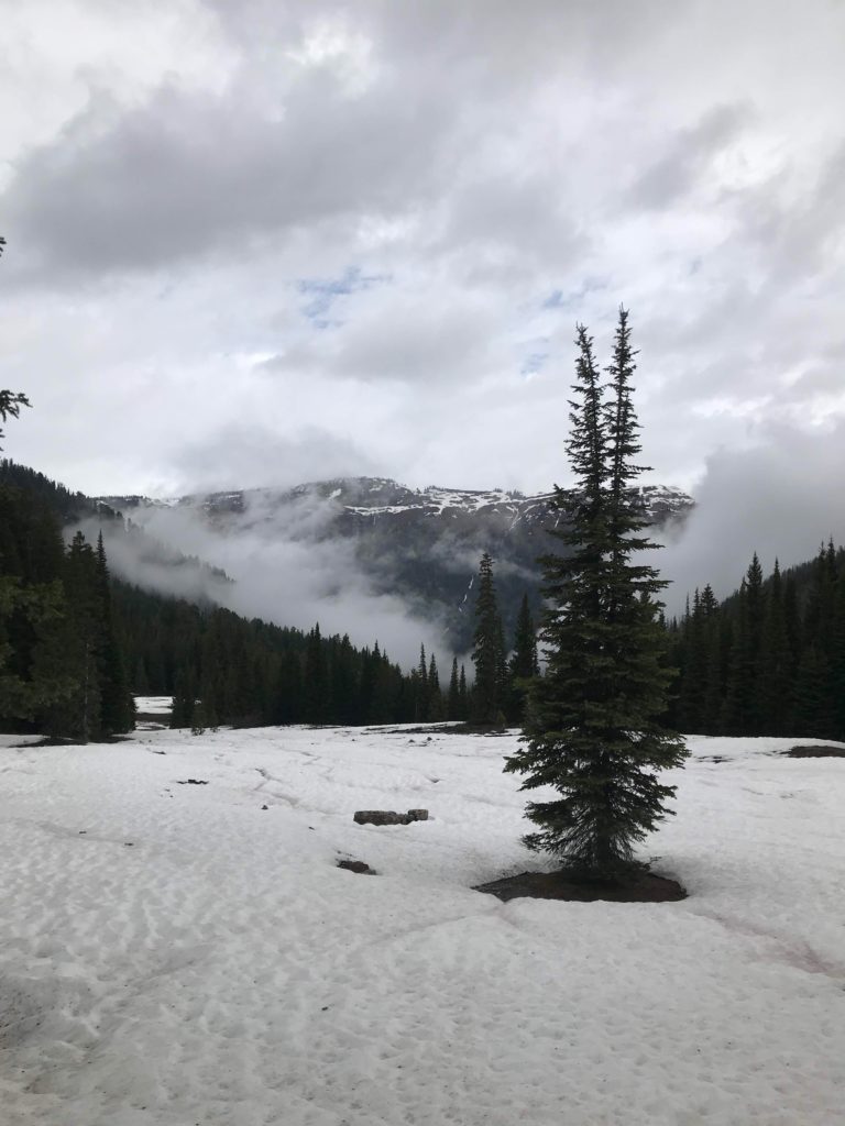
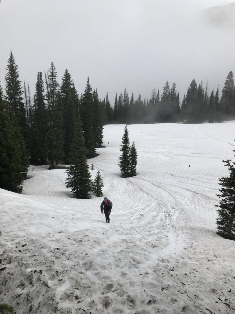
Snow/Tubing

The kids loved the snow.  That’s really all that matters.  We found places to sled, broke a few sleds, had a blast, made some memories, and it was so worth it.

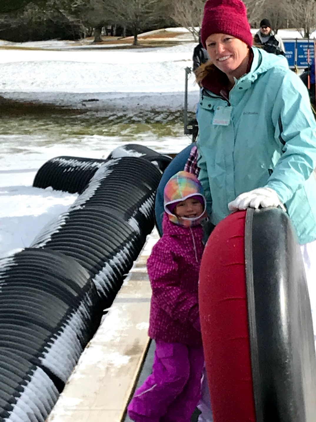
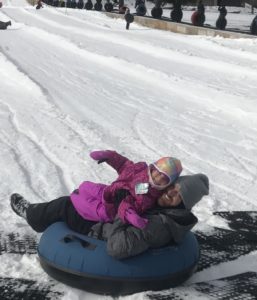
First on this list, we decided to go tubing at Sugar Mountain.  Word to the wise, make sure you get there to be the first group and don’t go during Christmas or New Years holidays.  We went a few days after New Years during the middle of the week and had a blast.  Friends of ours tried to go to the session after ours and it was so packed they couldn’t even find a parking spot. Early bird definitely gets the worm.  The experience was good, I appreciated the fact they were more safety conscious than Beech mountain and our kids both had a great time.  We chose here because our daughter at 4 years old could tube whereas she couldn’t anywhere else.  This was great.

Famous Brick Oven – Beech Mountain

We can’t say enough good things about this place.  We’ve been here a couple of times, and each time the food is absolutely phenomenal.  Yes, it is always a little crazy because of how busy they are.  However, they are responsive, friendly, and again the food is excellent.  Our favorites are the pizza and wings.  I am not sure if we were worn out from tubing and sledding all day or if the food was that good, but we drove from Sugar Mountain up to Beech Mountain on this day just to come here again knowing we liked it last year just to have it again.  If you are near Beech Mountain you have to give this place a try, and while you’re there draw a cool drawing representing where your from on a paper plate and put it on the wall!

Appalachian Ski Mountain

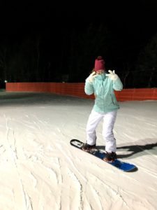
We decided to take on snowboarding at night after the kids were going to sleep at Appalachian Ski Mountain.  Being that it was right around the corner from the resort made it a big plus.  If you have to rent gear the process is a little confusing, but they have people standing around to help answer your questions.  The wait was probably 45 minutes, which I didn’t think was too bad considering how many people were waiting.  What was even better is once we got on the mountain there didn’t seem to be nearly as many people as we thought.  We rarely had to 
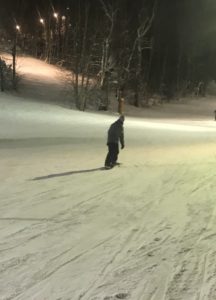
wait to get on the lift and the last two hours or so there was no wait at all.  It had recently snowed about 3 inches and they had a good base already from the man made snow.  The staff was excellent, helpful, and polite.  We will most definitely come back here again in the future!

Downtown Blowing Rock

The downtown area of Blowing Rock is really pretty special.  On nice days 
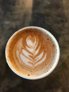
during the holidays it is absolutely jam packed, too packed for my liking.  However, there are so many neat stores, restaurants, a playground for the kids,   free covered parking garage, and an excellent coffee shop.  We highly recommend Camp Coffee Roasters right on Main St.  They coffee is excellent and the bakery items are just as good with other local items offered as well.  This area is a not so hidden gem, but one I can’t wait to come back to.

Summary

We are always happy to answer questions and love featuring some of our favorite places to visit on our trips.  The extreme cold this second week made it hard for us to do as many things as we wanted.  The high never got about 15 and the lows every night were around 1-3 degrees F.  While it is definitely a dry cold without the wind,  making it tolerable when the sun was out, the last two days the wind was blowing a constant 35mph and snowing and it was far too cold for the kids to be out in for more than a short period of time.  The windchill the last two days hovered between -10 and -27 and we just weren’t prepared with proper hand, feet, and face coverings for the kids.  We love this area of North Carolina and hope you do too!

North Carolina “High Country” – Week 1

Leading up to Christmas this year the kids really started to show signs of understanding the importance of why we really celebrate Christmas.  It began a few weeks before Thanksgiving while driving in the car with my son.  We drove past a retail center that already had Christmas decorations up.  He asked why they had the decorations up already, and I replied they are decorating for Christmas so they can get a jump start on sales for people buying Christmas presents.  He then said, “It’s not even Thanksgiving yet, they should really just care about Jesus’ birthday.”  We decided that we should take the chance to “get away” for a few weeks during Christmas break from school, and we ended up in the High Country of North Carolina to do some hiking.

Mt. Mitchell Area

Our first week in the High Country we stayed in the area of Busick, North Carolina.  Don’t worry you can’t find the city on the map.  It’s one of those places with no cell phone signal, dirt road access, and a beautiful running creek parallel to the road.  The road dead ends at the Black Mountain campground with several trail heads.  What it lacks in grocery stores, it more than makes up for with great trails, fishing access, and quiet.  It’s a short ride to the Blue Ridge Parkway with the only negative to that being when the road is closed due to Fog or Snow.

Catawba Falls Trail

On Christmas Eve we decided to get out of the house, do some geocaching, explore the area and do a short hike to a waterfall.  We found several geocaches as we circled from north of Mount Mitchell to the west near Burnsville then south toward Asheville before finally approaching our hike at Catawba Falls.  This hike was relatively easy.  We decided to wander a bit off the trail to try and find another geocache, but unfortunately we never found it.  The trail was about 2.1 miles out and back with a very modest 330 foot incline.   Follow this link here for more details and to see full hike details on the All Trails App/Website.  However, it did make for a great stopping point at the waterfall and a great way to stretch our legs.

Roaring Fork Falls Trail

Christmas Day was upon us and we needed to get the kids out of the house!  Lucky for us this trail was right around the corner.  This was by far the easiest trail we hiked.  If we’ve learned anything hiking with our 4 year old daughter, 
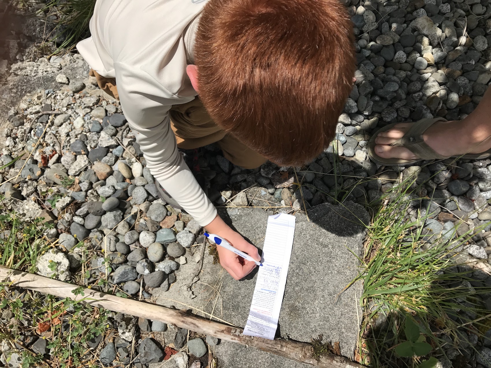
it’s that she absolutely despises easy hikes.  This hike is 1.4 miles out and back and there were no rocks or roots or heavy inclines.  We were able to find two geocaches along the way, one of which was one of the types our kids love to find…geocaches with random quarter machine toys that other people have left behind.  The falls weren’t the most amazing we’ve seen, but they were fun to walk around and the hike again was something to let the kids burn some energy.

Peak of Mount Mitchell

The day after Christmas we decided to drive around and see if we could find some geocaches.  For the most part we didn’t do much except hunt around for geocaches.  The Blue Ridge Parkway had been marked as closed for the previous few days due to some unreal fog.  I’ve never driven in fog some think in my life.  Driving about 15 mph I still almost hit several deer and a group of turkeys twice.  We got back to the house sometime around 4pm and I happened to check the Blue Ridge Parkway website for a status update.  Upon checking I noticed they had opened the parkway all the way to the road that leads to Mount Mitchell.  It was a rare sunny day this week, and I didn’t want to miss the opportunity to see the sunset from the peak of Mount Mitchell.  So we loaded up and drove way too fast to the peak of Mount Mitchell.  We got there in perfect timing too.  The temperature was about 22 degrees.  As we got to the peak I jumped out of the car and ran the 400 meters to the peak on the paved sidewalk.  I then had to wait about 5 minutes to have the burn in my lungs completely stop.  It was so worth it though.  The colors across the sky were unbelievable.  Had it not been so cold I could say up there for an hour just staring at the sky.


Pinnacle of the Blue Ridge

This trail was very unique.  It’s a 2 mile loop trail with an almost 500 foot elevation change.  There is  1 off road parking spot right at the trail head (which doubles as a park service access road).  However, if you drive 1/4 a mile up the road there is more parking and you can walk off the road in the grass.  This is a loop trail and if to find the trail head on the right you will want to use the All Trails app to find it because it is not marked.  The entire first half of this trail was through weird overhanging bush trees and basically a straight up hike.  It most definitely burned the calves.  It was quite strange compared to the rest of the mountain area trails though.  When you are walking through the first half all you think to yourself is please let this open up at least once to see something cool.  This trail did not disappoint.  When we finally made it to the high point the trees disappeared and we were able to climb boulders to find some pretty amazing views.  We hung out on the rocks for a bit, took a picture with our daughters class project (Flat Stella) and enjoyed some snacks for a bit.

Fly Fishing

While we/I were semi prepared for some fly fishing.  What I wasn’t prepared for was fly fishing in the bitter cold.  We made a couple of attempts in the South Toe River, but unfortunately the weather was just too cold and too cloudy.  Stay tuned for our next trip to this area when there’s warmer weather in the spring!  For now, enjoy a few pictures of our son having his first go at fly fishing.

River Loop Trail / Setback Falls

For the end of our first week and first location we decided to give one last hike a go.  First, the All Trails app was way wrong on how long this hike was.  Yes, it is a loop trail, but it was more like 4.5 miles instead of the 3.5 miles it said it was.  The end of the hike was very strenuous, and honestly the views weren’t that great.  The best part of this trail was the 1/4 mile side hike to Setback Falls.  What made the falls really neat was the fact that it was so cold the falls were mostly frozen.  The kids had some fun and we took some neat pictures as well.

First Week Summary

All in all, we loved the area.  There are so many trails to explore and geocaches to find and in warmer weather plenty of places to fly fish.  We’d love to come back here again.  What’s great about this place, is that it wasn’t chock full of tourists like us during the holiday time period!


Pacific Northwest!! Mt. Rainier Area (Post 7 of TBD)

For those that have been following our blog, we’ve totally slacked the last several weeks in coming up with our latest post.  Most of this is due to Hurricane Irma.  We’ll make a brief post on Irma later, but for now let’s focus on a few areas from Days 11-14: Mt. St Helens, Yakima, and some back roads fishing.

Mt St Helens

The weather really put a damper on our trip to Mt St. Helens.  It was cloudy and rainy the entire day, not unusual, but annoying when you’re a tourist.  The drive to the volcanic wonder site taking some back roads was very pretty, which almost made up for the clouds.  The visitor center at the Johnston Ridge observatory was very crowded, but extremely informative.  We actually made 2 trips to the observatory that day.  We were headed down about a 30 minute ride away when I thought I saw a break in the clouds.  I took a chance, turned the car around and we headed back to the observatory and we were blessed with a slightly better view.  It wasn’t perfect, but it was better than nothing!  Learning about the eruption, how it affected the area, and the environmental changes was awe-inspiring.  You can still see acres upon acres of trees fallen down and the re-growth hasn’t even begun yet and it may never begin.  However, the surrounding areas once you get to that clear line where the devastation wasn’t as bad, is truly beautiful with large tress and lush growth.

Cowlitz Falls Park and Random Hiking

For most people, you won’t hear much about this little park.  It isn’t even really a park as much as it is a parking lot.  However, this little area was pretty neat.  We brought the fishing gear and some waders on this day with some live worms and figured we’d give it a shot to catch some trout.  There are so many areas of Washington with dams and fish hatcheries for Salmon and Trout.  We didn’t really plan to do fishing on this trip, though the AirBnB we stayed was gracious enough to let us use all their fishing gear!  At this park, they have some picnic tables, where we sat and ate lunch, and they have a little alcove of water set apart from the Cowlitz River and that is where all the locals come to fish.  There were no tourists here.  The people coming to fish here were locals and they were fishing for their 3 limit max of Rainbow Trout per person for food that night.  Laura and Evan tried their luck with a lure on the river side while Olivia and I tested our luck with the worms.  It didn’t take long, after about 30 minutes we had our first bite.  I let Olivia reel it in and it was a beautiful rainbow trout, very small, but a pretty fish and she had fun reeling it in.  Though she made sure to let everyone know daddy caught it she just reeled it.  There’s no fooling her even though we tried to convince her she caught it.  From here we decide to drive around and thought perhaps the roads might be open to the Western side of Mt St Helens.  Unfortunately, they weren’t but we did some GeoCaching, random hikes, and a fun bumpy ride to scare everyone as we went downhill!  We stretched our legs a bit, saw some beautiful scenery, and better yet we were the only people for miles!!

Oak Creek Wildlife Area, Naches, and Yakima

This day was a VERY rainy day.  In fact it was rainy everywhere we went except Naches.  Which very amazingly is the area where just about every Washington apple sold comes from it seemed like.  There were rows upon rows of Apple and Cherry trees.  On top of that, the warehouses with all the apple crates outside were pretty neat too.  Laura kept wishing she could have brought an apple crate home for an home decoration idea.  On this day we stopped for lunch at the Naches Applewood Park.  It was a nice little park with a lot of open space, a couple of playgrounds and a swimming pool.  We enjoyed our picnic lunch before the rain came at this stop too.  Before Naches we decided to venture to Oak Creek Wildlife area.  Let’s just say in the summer, it’s pretty bare and the animals are pretty scarce as well.  The road is not recommended if you have a minivan as it’s very rough.  We drove for a mile or 2 before turning around.  In the winter this is a designated safe zone for animals and it’s really helped re populate various animals.  We ventured after Naches to Yakima, if you go to your local Publix in Florida you can buy Yakima Apples for a whopping $4 per pound whereas in Washington they are $.99 per pound.  Quite a lot of transportation cost associated with those apples.  There isn’t much going on in Yakima, it’s a pretty big city and had a nice little outdoor shopping center, but other than that we didn’t do much there.  We then battled a heavy rain on the way back to Packwood.

Sunset of Mt. Rainier

While it was rainy for the majority of our time this week in Packwood, we were extremely blessed to capture this picture here.  We took Snyder road up to NF-1260 where at the very top there’s a host of trails you can take as well as some back woods camping spots.  In the rain a few nights prior up here we saw a mom dropping of her two teenage sons to go camping.  This night however, we didn’t go all the way to the top.  A short ways from the top there’s an electrical station of some type with a massive antenna and an absolute perfect clearing to see Mount Rainier.  The picture doesn’t even do it justice at all.  The sun was setting and the clouds were moving away and left this amazing ring of clouds around the mountain that was just really neat to see.  Couple that with the sunset and it made for a perfect evening for just Laura and I.  Laura’s mom graciously watched the kids and got them ready for bed for us so we could go do that and I am so thankful she did!  We might not have otherwise been able to get the picture.

This wraps up our post this week, stay tuned next week as we detail our drive from Packwood to Vancouver by way of Seattle and Everett.

Pacific Northwest!! Mt. Rainier Area (Post 6 of TBD)

Days 8-10

These next few days were like going through a time warp between summer and winter in the same day.  It was quite bizarre.  On these days we did some more GeoCaching, made our own trail, went sledding in the snow, hiked across a waterfall, and enjoyed the Mt. Rainier area.

Mt. Rainier

Our first day scoping out Mt. Rainier was a busy one and we didn’t even get to see the mountain!  However, we had an absolutely blast!  The day before on our drive into town we had already scoped out a few spots to stop and hike along the way.  This helped make the day a little easier.  Being that the house we rented was not equipped with internet…or cell phone signal, we had to rely on Blanton’s Market in town for their free wi-fi.  Don’t fret, we did go in and buy something every single time!  If you are in the Packwood area, Blanton’s really is a great little grocery store with very reasonable prices and fresh fruits and veggies.

Sledding

Alright onto our day.  Our first activity…snow sledding.  Yes…you read that right, snow sledding…in June!  We had a blast.  It was pretty cold, about 34 degrees,

but for the most part we had plenty of warm clothes.  Poor Evan though, we didn’t quite pack the right pants for him and his pants weren’t really water proof.  So he rode around in the car without pants on afterwards for a little while.  He didn’t care though, he had so much fun sledding it made it up for all of it.  The house we were staying through AirBNB had a sled they offered for us to use so we took full advantage and were just lucky enough to find a great spot to do it.  Click here to see a funny video of our hiking adventures, click this link https://youtu.be/sg8ff_iMCKg

No Name Hike

Anyone know what the best kind of hikes are?  The ones were you rarely run into a soul.  There’s just something about the ability to get out into nature on a random trail with only one parking spot for a vehicle and making it your own.  I don’t even believe this trail had a name to it as it didn’t appear on my Washington Trails App.  However, it was very quick, and had an amazing view of the river  at the end.  We threw rocks, walked across a series of logs that had piled up and just enjoyed the atmosphere at the bottom of the mountain where there was no rain or clouds.

The View Itself

I’m not going to lie, I really wish we had delayed our trip a few weeks so that we could have had better weather and trail conditions.  However, had we done that we would have encountered so many more tourists on the roads and trails of Mt. Rainier.  So, because of the weather and the shear number of people, we didn’t spend much time near the visitor center or driving around.  We did the one drive through the park so that we could saw we did it, and came away with the view to the right on the one sunny day.  That day was pretty incredible as every turn we made we were fortunate to have a different perspective to see the mountain.

Comet and Christine Falls

This hike was really pretty interesting.  It was one of the more strenuous hikes because it was essentially straight up.  As we hiked up, we passed multiple groups coming down who said they turned around because they couldn’t pass, 
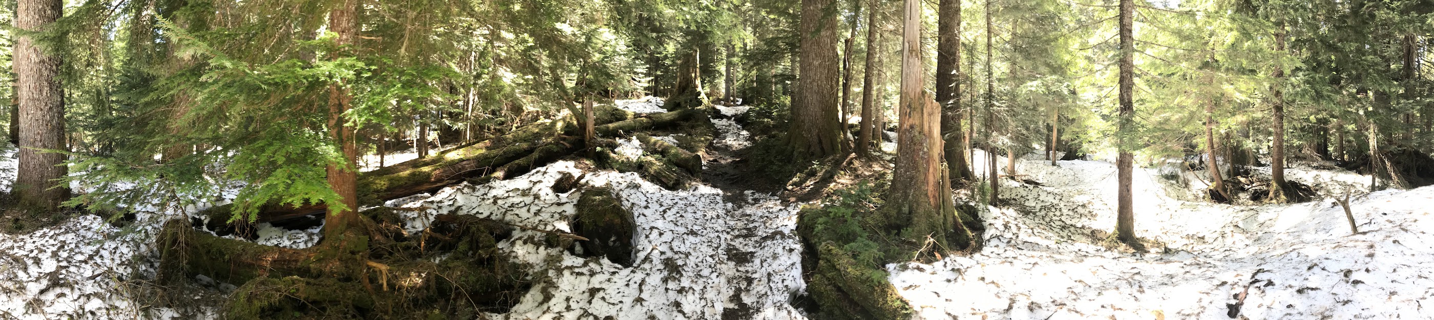
the snow became too difficult.  The hike itself had some really pretty view in the short distance.  However, we did come to an area where we could not pass with the kids.  It was what looked like was a usual slanted rock stretch heading straight down about 200 feet to the bottom.  What made this difficult was the snow build up.  It was just any snow build up.  No, this snow build up had half way melted and had left what was essentially a hollow cave/bridge for you to walk over.  It was probably at the most 18 inches thick, so walking across it was pretty dangerous.  We chose not to bring the kids, and in fact I was the only one that kept going.  I knew by looking at the WTA app that I wasn’t that far from the last waterfall, maybe 3/4 of a mile.  I made it across and started jogging.  Without a carrier and other baggage, it felt like I could run for days…that didn’t last long though haha.  I eventually made it to the more difficult snow area and I just kept sinking down in the snow. It was actually pretty painful on my knees catching me off guard each time.  The view was so well worth it though and if there was more time I would have kept hiking even further.

Cora Lake Trail

Now technically this trail wasn’t within Mt. Rainier National Park.  It was actually part of the “sister” park the Gifford-Pinchot National Forest.  What was amazing about this trail was we were literally the only people anywhere within miles.  We traveled up a random forest service dirt road.  It appeared to be serving more as a logging road lately as they had been doing some planned clearings to help the over growth.  The hike itself wasn’t difficult, finding the geocache on the hike took a minute, but it was fun.  The hard part was finding the other geocache at the end of the trail.  We spent probably an hour trying to cross the creek where the trail typically crosses.  However, the water must have been extra high this time of year and didn’t give us anywhere to cross safely with the kids.  So we ended up leaving our daughter, who had fallen asleep in the carrier, with my mother-in-law and backtracked a little bit to cross at a place where a small tree had fallen across the creek.  Just because the creek is only 2-3 feet deep and 15 feet wide, doesn’t mean it is easy or not scary to have your 6 year old cross.  However, him and I and Laura all made it across. We then double timed it around the trail.  We had to cross the creek again up stream from the waterfall.  This crossing was much easier.  When we finally made it to the end, it was truly a beautiful view.  With the clouds and mist it was an eery view that was really different from normal view that made this unique.  We never did find the geocache.  There was so much heavy snow around that was packed tight, it was most likely buried.  We then proceeded to go back down.  What we realized when we started following the trail down is that when we were first trying to make it up we couldn’t really find the trail and there were a lot of fallen trees headed straight up hill.  We tried to pass that way but going uphill it became too difficult.  Going downhill though we thought we’d give it a try and cut off about 3/4 of a mile of walking, plus gain a little adventure and training for our 6 year old.  We repelled down the side of the cliff/mountain, grabbing onto whatever limbs/trees/branches we could.  It was quite difficult, but still fun and it saved us some time for sure.  We finally made it to the bottom of the trail ready for a snack!

Summary

Due to the weather, outside of the few hikes mentioned here, we spent a good bit of time looking for GeoCaches.  There are so many in the area, it made it quite fun.  It got to a point where anytime we would slow down the car, my son would flip his seatbelt out and yell out “are we geocaching??”.  Up next Mt. St Helens, Packwood Area, and Yakima.

Pacific Northwest!! (Post 5 of TBD)

Day 7 – Drive from Glacier, Wa. to Packwood, Wa.

It’s hard to believe our first week is in the books.  The drive to our next destination, an AirBnb house in Packwood, Wa is about 214 miles.  However, what’s a road vacation and road trip without going off the beaten path.  What should have taken us 4.5 hours, ended up taking almost 10 hours.   You may be thinking, what in the world took them so long.   Well our trip was filled with GeoCache stops (at least a dozen), random pull offs to look at train tracks, rainbow chasing, and a waterfall hike.

The Backroads & Skykomish River Railroad Crossing

Google Maps kept telling us for the fastest route to pick up Interstate 5 and head south.  We weren’t really interested in that because you miss so much of the countryside.  Instead we took State Road 9 south from Deming, thru Sedro-Wooley (and a GeoCache!) before we finally catch Highway 2 south of Lake Stevens.  We really didn’t know what was around us, we were just kind of driving and stopping when we wanted.  When we came to the Lake Stevens area, it was really beautiful.  The houses surrounding the lake were really neat, and the entire town was very quaint and welcoming.  We kept thinking to ourselves, where does everyone work.  Then you look at the map and realize how close you are to Everett and Seattle.  Now you may be looking at the map and saying why did they take Highway 2, it doesn’t go toward Packwood.  Well I had done some research online before our trip and saw this railroad bridge near Gold Bar, Wa that crosses the SkyKomish River with mountains in the 
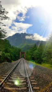
background.  I was not driving through that area, even if it took us an hour out of the way, without seeing that.  It was really amazing because it was absolutely pouring down rain when we got there.  I tried looking at the weather radar and it kind of looked like in half an hour or so there may be an opening.  So we drove past it and decided to look for a GeoCache.  Though, that search turned out to be a DNF.  The Cache was right off the road somewhere, it was pouring down rain, and the ground fell straight down off a cliff.  So I didn’t even let the kids get out of the car.  We drove back to where the bridge was and it was amazing.  The “break” that I thought I saw on radar was actually coming.  I made Laura jump out of the car and go down to the tracks with me even though it was still raining because I could see the blue sky opening up a bit.  Once we got down there it was perfect for about 3 minutes, we had the picture we were looking for which you see here.  It was well worth it deviation from our path and the small town of Gold Bar was kind of neat too because we stopped in the park and found another GeoCache!

Snoqualmie Falls

As we continued our drive we made a quick pit stop at Snoqualmie Falls.  This wasn’t a pre-planned stop until the morning we left.  We were looking for a short hike to do to stretch our legs and maybe see a waterfall.  What we didn’t expect was a massive tourist resort.  This place is huge, and when I say it’s a tourist trap it really is.  There is a giant resort, tons of parking, and tons of people. The trail is even mostly paved.  The view was pretty neat, but we did not stay long, we looked, we walked, and then we left.  We proceeded down the back roads taking us through what looked like an entirely planned city surrounding this waterfall.  It was pretty neat…until we hit rush hour traffic from people getting home from Seattle.  We didn’t go anywhere for close to an hour.  We finally made it through and continued our journey approaching Mt. Rainier.

Mt Rainier Approach

Well there isn’t much to say about this day, it was extremely cloudy, misty rain, and cold.  We could not see the mountain at all.  In fact we could really only see certain portions of the side of the road.  We did manage to catch one picture in the car looking forward just driving through the park as we got to lower elevations.  The picture was pretty cool and I thought we should share.

Pacific Northwest!! (Post 4 of TBD)

Days 5 and 6

Of all our trips, the days are when we just get in the car and go without a plan.  When I say without a plan, I really mean, we are going to a general area and if we see something cool we are going to take that path.  Often times, these paths are representative of the Robert Frost poem.  We almost always like to take the path less traveled by.  During our last two full days in the Glacier, WA area we decided to head back towards Bellingham and also towards the Cascadian Farm.  Some of our visits these days include:  Cascadian Farms, Baker Lake, Chuckanut Drive, Taylor Shellfish Farms, The Filling Station, and GeoCaching!

Cascadian Farms

If you are like us, and have kids, you have tried to purchase all organic groceries.  In addition, like us, you probably haven’t been successful in incorporating this into your every day life.  However, that didn’t stop us from wanting to visit the Cascadian farm in Concrete, Wa.  One thing we loved about Washington was all of the farms and gardens people had in their yards.  It definitely got us in the mode of wishing we could have gardens here like they do in Washington.  Here we have two pictures, the first being the obligatory picture of the small building on the property.  In the building they sell a few snacks and milkshakes and ice cream hand made on site.  It was definitely delicious.  We sat out back, enjoyed our treats, and the view.  In the second picture, we have a row of new growth starting up.  There actually wasn’t a sign to say what it was.  However, the more interesting part about this picture is the woods to the left.  To the left on the mountains and directly behind the Cascadian Farms building is all protected forest land.  What’s even better is the land was designated as such by local families that owned the land.  They chose not to develop the land, but to set up a natural habitat.  Who is this natural habitat for you may ask.  Bald Eagles.  In the winter they come by the thousands to this one area.  It is so popular that the town of Concrete, Wa has a Bald Eagle festival every weekend in January!

Baker Lake

Baker lake was not one of those places we planned to attend.  However, we are so glad that we did!  It was truly a beautiful, quiet, and peaceful area.  We were driving around looking for places we might be able to cast a line in the water in the Skagit River.  For the majority of this trip, we did not have any cell phone signal, so if we didn’t know 100% where we wanted to go in advance, we had to use a paper map.  Yes I said a paper map.  I am thankful that as a kid I was forced to learn how to read a map.  Not just a driving map, but essentially any map you put in front of me, I can read it, understand it, and know where I am.  As we were looking for fishing spots I looked on the map and saw this lake as well as a road that wound is way around varying high points of mountain points, which typically signals there are trails present.  We decided to just take a chance at a side road in the town of Concrete and it led to a road up the mountain.  When we go to the top of this initial road we were blessed with a 3 second view of mountain ranges in the distance to the south.  We then proceeded on the other side of this mountain where we entered the Baker Lake area.  In one of the more picturesque places of our entire trip we snapped several photos that as usual don’t even do the area justice.  I could have stayed here for days just enjoying the view.  The first stop we made was Panorama Point Campground.  Yes you can camp with this view.  It is absolutely amazing, stunning, and literally unbelievable.  We stopped to have lunch here at the campground and just enjoyed the view.  After lunch we drove across Baker Lake Dam.  By the way….the Dam is super cool and eery at the same time.  When you drive across, you feel like you are only a couple feet above the water level.  My wife had her eyes closed and just kept repeating please drive please drive.

So of course I slowed down for some amusement.  This was a quick stop, but not the last of our Baker Lake area adventures.  We saw a side road that didn’t appear on the paper map, but seemed well traveled.  On my All Trails app, it showed a trail at the end of the road, so we decided to give it a shot.  It was definitely a long, bumpy, pot holed covered dirt road.  I don’t really know how long it took us to get to the end.  We never even made it because the road turned to complete snow.  Other cars parked where we had and walked the 3/4 of a mile more to the beginning of the trail head.  We definitely have added it to our bucket list because the pictures we’ve seen from others hiking this trail are amazing.  Do a quick search or click here and check out Park Butte Lookout.  You will not be disappointed.

The long random drives and stops for lunch made our day go by quick, so we took a nice drive back to the timeshare and stopped along the way to do some GeoCaching!

Bellingham – Part Deux

Let’s see if we can keep this narrowed down a bit since I’ve already chatted a bit about Bellingham.  Even though it took our second trip to Bellingham to visit these areas, you absolutely MUST visit these.  First, a winding drive mostly covered by State Park protected land, Chuckanut Drive.  I can see this being a beautiful relaxing drive by bicycle.  In the rain, the car was much better.  Again, even in rainy weather this drive was incredible with stops overlooking the water, numerous trails and amazing houses in places along the way.

We just happened to be driving down Chuckanut drive when I saw a sign for Taylor Shellfish farms.  About a half mile back I had stopped at an overlook and saw massive Oyster Shell Farms located in the water down below.  It was really quite interesting reading about them and the value they play to the ecosystem out there.  With the issues our local waterways and ecosystem are having here, it was really neat to see how valuable the Oysters can be people are placing here.  In typical fashion for our trips I decided to turn off.  Don’t be alarmed, yes there is a straight down hill driveway, yes you cross the rail road tracks where there is a small rail port holding area that you drive right along.  It seems as though you shouldn’t be allowed to drive down there.  If you keep driving, eventually you get to Taylor Shellfish Farms.  It’s a very neat place, selling all types of Oysters.  We got 2 Dozen of varying types, I shucked them all and we downed them in no time.  I grew up eating Oysters (in Florida only in months ending in R).  My wife and mother-in-law on the other hand did not.  This picture and video says it all  at the link to the right.  https://photos.app.goo.gl/N1NapfUFuVHfC0el2 This was an experience for them.  It was rainy and cold outside, but you shuck em and eat em and toss em all outside onto the shore below their dock.  Really you must stop here and if nothing else learn about the local culture and history.

The Filling Station

For lunch we decided to stop and eat somewhere.  I think we only did this for lunch twice in our entire 3 week trip as eating out is very expensive out here, especially with kids.  That being said, this was a pretty neat place.  
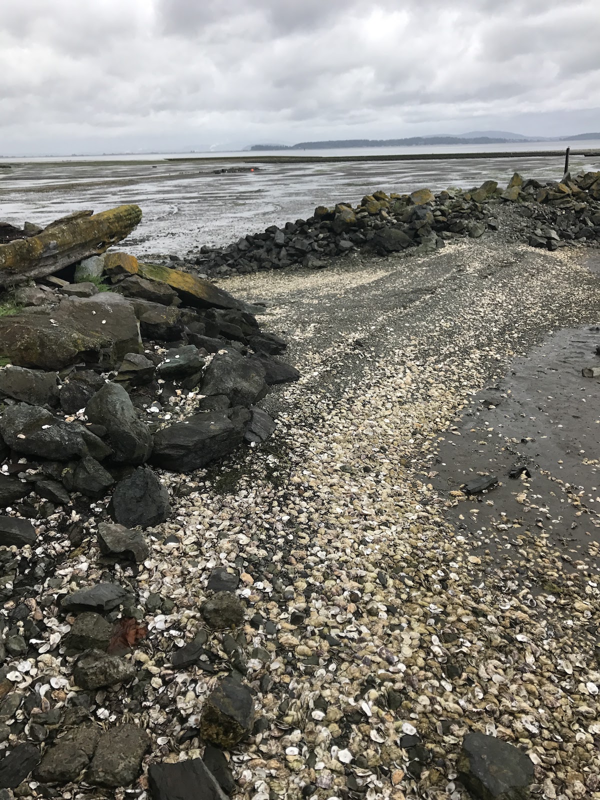
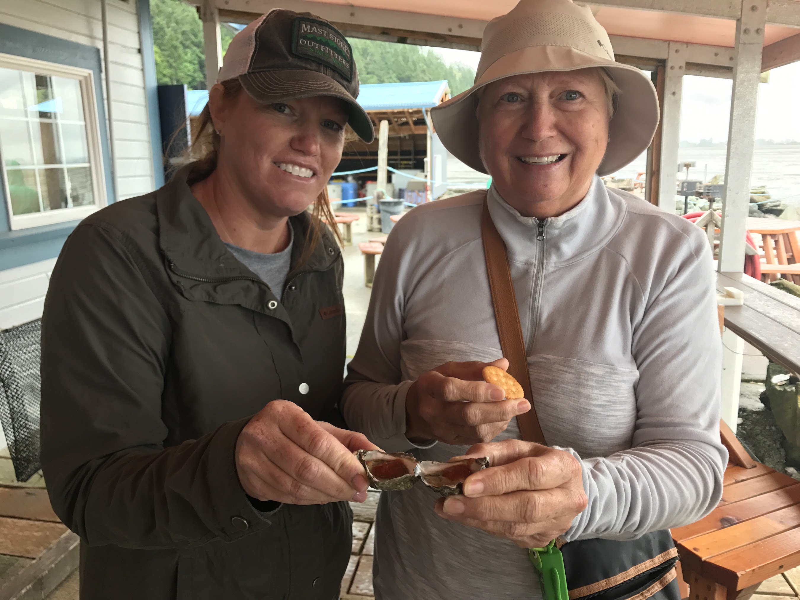
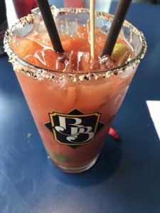
They had Bloody Mary buffet so you could build your own.   They bring your glass with Vodka in it (yes they have Bacon Vodka!!!) and you go up to the bar and pick your own ingredients and fill your glass yourself for your own custom Bloody Mary. Really quite a neat perspective and way to get people to try something unique.  They had a really good tea that day made with mint, lavender and perhaps one other thing I can’t recall, but it was delicious.  The food was good as well, several unique items to choose from that made it difficult to pick just one.  All told, we highly recommend you give this place a chance.

That pretty much concludes our last two days in the northern half of Washington State.  Up next…our drive from Glacier, Wa to our “home” for the next week, Packwood, Wa.


Pacific Northwest 2017! (Post 3 of TBD)

Days 3 and 4

So we’ve given you a brief overview of our trip to Washington as well as our first two days.  Now we are going to give you a quick look at days 3 and 4 of our trip.  Up on tap:  Scenic Highway 20, Thunder Knob Trail / Diablo Lake, North Cascades Visitor Center, Washington Pass Overlook, Heliotrope Ridge Trail, and Chair 9 Restaurant!

Scenic Highway 20

We began our 3rd day in typical fashion with a stop at the Wake ‘N Bakery.  From there we proceeded south toward the town of Sedro Wooley.  We then picked up highway 20 to head east.  The drive is absolutely beautiful and winds through several small towns.  On a clear day you can catch glimpses of Mt Baker and many other peaks.  On this day we were fortunate enough to have one of our few completely sunny days.  Our first stop was the North Cascades Visitor Center.   The turn off is relatively obscure, but the center itself is pretty neat.  Boasting a 3D topographical map, video about the area and a gift shop with the usual Park Service trinkets.  A short jaunt down a boardwalk out the back of the center leads you to a nice little view of a glacier.  After this quick pit stop, it was time for our first  hike of the day, Thunder Knob Trail

Thunder Knob Trail

Round trip this trail is about 3.5 miles.  It is also almost completely straight up.  It’s a pretty steep climb once you really get into it.  However, the work is well worth it!  We didn’t see many animals, just a few chipmunks, but the stench of possibly some bobcats was nearby.  About half way up you get to a clearing where you get a glimpse of something so spectacular it makes you want to sit there and just stare all day.  Alas we needed to move on to see what was at the top!  This hike most definitely worked the calves toting a little one on the back, but our Deuter Kid Comfort III saved my back and shoulders!!!  Once you get to the top though, you are rewarded with a gorgeous view of Diablo Lake.  There are numerous sub trails you can take at the top to walk around for differing views.  If you are lucky enough you can get a chipmunk to come up to you.  This is another spot in which you can sit and stare for hours.  It’s extremely peaceful and you’re lucky if you pass two other groups of hikers on the whole trail.

Washington Pass Overlook

Drive a little further, and by a little I mean a few hours further, and you reach the Washington Pass Overlook.  At 5,400 feet it’s the highest point you can drive to in Washington State.  On the day we drove up we were forced to park right at the entrance off Highway 20 due to snow covering the road way.  However, that made for a more fun walk up to the boardwalk lookout.  The road was pretty clear, but the kids had more fun running in the snow and throwing it.   As with every stop we made this trip, the views were unbelievable.    With an amazing view of Liberty Bell mountain and the surrounding snow covered woodlands, this was well worth the several hour drive.

Heliotrope Ridge Trail

In what was perhaps one of the most fun hikes we have done with our family, the Heliotrope Ridge trail did not disappoint!  The access to this trail is just down the road from the Visitor Center for the Park Service in Glacier.  Once you turn down the Forest Service road, it is quite a long drive up a very narrow road.  Regardless, the drive is pretty bumpy, but oh so beautiful.  Once you arrive to the end of the road you have reached the trail head.  I will post a few pictures here of the trail, but they don’t even come close to doing it justice.  Determining the full length of this trail was difficult due to all the snow.  Based on our trek using the All Trails app tracking our GPS location, roundtrip we hiked 5.8 miles and exceeded 2,800 feet in elevation climb.  Our 6 year old Evan hiked the entire trail roundtrip with no problem.  Our 3 year old Olivia hiked the first 1.75 miles on her own before finally succumbing to our Deuter Kid Comfort 3 carrier.  Pretty impressive from both kids as the hike was almost entirely straight uphill.  From the moment we hit the trail we had to deal with snow.  Three areas in particular where both sketchy walking across and beautiful at the same time.  The first is at this small location of a waterfall where everything else is covered in snow and you have only a small thin path in the snow to walk, one slip and down you go to the bottom!  Even more astonishing was the view as you look the opposite direction from the waterfall.  For as far as you can see there are snow capped mountains and the view is just awe inspiring.  The second was right before crossing the creek leading down from another waterfall.  The creek was harder to cross on the way back as the snow melt later in the day had increased the water flow.  Lastly, when we got to the stop, the snow was so deep, but as we were walking we could hear the water just rushing underneath us.  It was very neat to hear, but at the same time a little scary knowing at any moment you could fall through.  Lastly, at the top you are again blessed with an assortment of views with more snow and beauty.  We took a break at the top to enjoy some snacks before heading back down.  At this point we were covered in snow.  Thankful we had some great hiking shoes and waterproof clothing…well most of us did anyway.  My poor son’s pants were not waterproof, but he was a trooper!  All told the hike took us approximately 4 hours roundtrip.  We began after lunch around 1pm or so and made it back to the car around 5pm.  When you have kids, hikes always take longer, but we wouldn’t have changed it for anything.

Chair 9 Restaurant

After a long tiring hike we didn’t want anything to do with cooking dinner.  We were fortunate Chair 9 restaurant was on the way right outside the trail and right before Snowater, where we were staying.  With free wifi, ice cold beer, and coloring pages and crayons for the kids, we were set!  The pizza was excellent, the staff friendly, and the environment was really great.  We couldn’t say enough nice things about this place.

That does it for days 3 and 4.  We hope you enjoyed this post and look forward to our next post!


Pacific Northwest 2017! (Post 2 of TBD)

Overview

As our previous post mentioned, we spent the first week of our trip staying in Glacier, WA.  What we didn’t say was we did a great deal of driving and exploring.  We enjoyed ourselves so much we are hoping to come back next summer.  Enough rambling, we’ll get to the details we hope you enjoy as much as we did.  At the end of this post we will post a link to our Google Photos folder from the first week of our trip.  To the right is a picture of the kids standing in front of a giant Douglas Fir on display at the Glacier National Park Service Center.  They couldn’t believe trees grew that big!

Day 1 – Deception Pass & Bellingham

In what became a seemingly daily ritual, the sky was cloudy and the rain misty. It was that type of rain that really doesn’t even get your clothes wet, just a little damp.  We started our day with a stop at the Wake ‘N Bakery to grab a couple magic cookie bars and we were off toward Bellingham.  After an almost two hour drive we arrived at our first stop…Deception Pass.  One can only imagine what the views are like when the clouds disappear.  Even so, the views were phenomenal.  The kids enjoyed climbing the rocks and walking the short trails.  The view from very entrance at the park front he bridge is even more fascinating and again one can only wonder how amazing it looks in person when the sun is out or even better at sunset.  Anytime you can take a minute to go somewhere different, experience something new, and see God’s true wonder and beauty, it’s as though it takes your breath away.  These scenes made me just want to sit there and stare at them for hours.  From there we took a short little jaunt to Boundary Bay Brewery in downtown Bellingham.  The beer was excellent and the food just as excellent.  There was a really great farmers market going on right across the street that was filled with anything you could think of from the local community.  Since this was our first full day in Washington we spent the rest of the day going to the grocery store and heading back to condo to get situated for the rest of our trip.  This was a great first day to get acclimated to the time change (3 hours) and experience some local culture.

Day 2 – Horseshoe Bend & Mt Baker Ski Area

We decided to begin our northwest hikes with a relatively simple trail, Horseshoe Bend.  This trail follows the Nooksack River for approximately 2.5 miles roundtrip.  There is virtually no incline of any significance, but the beauty of this trail was phenomenal.  Our kids really liked this hike to get us started.  Evan is six and Olivia is three.  On our entire trip Evan did every hike, faster and better than us adults!  Olivia did as well as she could for most hikes, but really it was a 50/50 chance whether she’d want to hike or not.  She did enjoy this one very much though for it’s relative ease.  The flow of water here is absolutely unbelievable.  The power behind this river is  unlike anything I’ve ever seen.  I have no doubt there’s greater, but this was really amazing.  After this little hike we pulled off the side of the road and had a picnic lunch at the Shuksan Picnic area.  This was a really nice place with picnic tables and areas to walk down to the river and throw rocks and walk along the water.  From lunch we proceeded our trek toward Artist Point Ridge trail.  The drive up was absolutely stunning.  The one problem….we could only make it to the Mt Baker Ski area.   Everything continuing on was blocked by snow.  This area received 271 inches of snow this winter, that combined with a late snow and unusually cool temperatures has made the snowmelt end later in the season.  So our entire plan of hiking the Artist Ridge trail was foiled by all the snow.  We didn’t let that stop us though.  We decided to attempt to just start hiking in the snow to see how far we could make it.  We didn’t make it very far, but the views were absolutely spectacular! The drive up was well worth it just for the views alone.  We headed down the mountain and made a quick stop to see Nooksack Falls.  There is no hike to these falls, you park and walk maybe 100 feet to the viewpoint.  It was beautiful and the history behind the falls and the attempts at delivering power to the area were very interesting as well.  There’s a road that continues from the falls, but is off limits to vehicles.  You’ll need to walk from there.  We didn’t walk up this way, but Glacier Service Center recommended it to us for a rainy day as it’s mostly covered with trees and can keep you dry.  It’s just a nice little walk to see the sights and apparently animals frequent this trail.  When Mother Nature changes around you and delays your plans, you just roll with it.  This was a great day and the views were truly spectacular.  We definitely recommend doing the Artist Ridge hike in July – September.  If/When we make it back this way, this is going to be tops on our list and we will be more prepared with snowshoes!!